We are most likely to learn the best methods of discovering truths, by
examining how truths, now universally recognized, have really been
discovered. William Whewell
(1794-1866)
The above histogram starts with the birth of Thales,
the earliest major scientist we can name (c. 624 BC).
Scientific achievements of equal or greater magnitude predate Thales
by at least 1200 years, as the
cuneiform inscription on a
famous clay tablet goes to show:
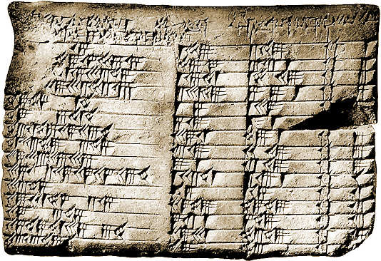
(2018-09-14) Mesopotamian Trigonometry (Larsa, c. 1800 BC)
Sexagesimal numbers recorded in cuneiform script on a famous tablet.
Apparently, the tablet discussed below was first analyzed in:
This is a burned clay tablet measuring 13 cm by 9 cm.
Its style indicates it's from the kingdom of Larsa;
dating it between 1822 BC and 1784 BC.
The headings at the top of each column of sexagesimal
numbers are written in
Akkadian
with some Sumerian words
(as was the usual practice at the time).
We're happy to ignore them entirely. Let the numbers speak for themselves...
This famous tablet is known far and wide as
Plimpton 322.
We'll simply call it the Larsa tablet in the following
discussion. It gives very special examples of what we now call
Pythagorean triples:
Integers which form the two sides and the diagonal of a rectangle:
h 2 + w 2 = d 2
The larger of the two sides (h) isn't listed in the Larsa tablet,
but we've restored it in the following transcription,
as a new column shaded in grey ,
after the rightmost inscriptions
from the original tablet (namely, the line number from 1 to 15,
preceded by a word which translates as row).
That grey number ,
henceforth called h, is always a regular sexagesimal number,
namely an integer whose reciprocal can be expressed exactly in the sexagesimal
numeration system used by the Sumerians
(in this context, the term regular seems due to
Neugebauer).
So, the ratio w/h can be given exactly
in sexagesimal and this is what appears in the first column
(there's no terminating decimal expression for this, in any of the listed cases).
The second (w) and third (d) columns
are just integers which we chose to express in decimal,
rather than sexagesimal, for the sake of modern readers
(all bases of numeration are equivalent for integers).
In two highlighted cases ,
the ancient table forwent coprime integers
in favor of something sexagesimally simpler:
As 60 is simpler than 4 in this context,
the celebrated 3,4,5
Pythagorean triple appears here as 45,60,75.
Transcription of Plimpton
322 (after correcting 6 ancient typos)
Sexagesimal Ratio (w/h)2
Width (w)
Diagonal (d)
#
Height (h)
.59.00.15
119
169
1
120
.56.56.58.14.50.06.15
3367
4825
2
3456
.55.07.41.15.33.45
4601
6649
3
4800
.53.10.29.32.52.16
12709
18541
4
13500
.48.54.01.40
65
97
5
72
.47.06.41.40
319
481
6
360
.43.11.56.28.26.40
2291
3541
7
2700
.41.33.45.14.03.45
799
1249
8
960
.38.33.36.36
481
769
9
600
.35.10.02.28.27.24.26.40
4961
8161
10
6480
.33.45
45
75
11
60
.29.21.54.02.15
1679
2929
12
2400
.27.00.03.45
161
289
13
240
.25.48.51.35.06.40
1771
3229
14
2700
.23.13.46.40
56
106
15
90
Against clear photographic evidence (consider especially rows 10 and 11)
some scholars think that a leading "1" sexagesimal digit once appeared to the
left of all entries. That would make the listed values correspond to:
(d/h)2 = 1 + (w/h)2
This is utterly unimportant, unless the table is extended to include
very low values of w/h which would normally entail a leading zero
sexagesimal digit
(something cuneiform notation would not handle properly until 300 BC or so).
We'll come back to that.
Putting it in a broader perspective :
All entries on the Larsa tablet are based on
even values of h,
with the exception of its last row (#15) which would correspond to an
odd value of h if simplest terms had been given
(as is the case for the equivalent entry
highlighted
in the table below).
Odd values are not only possible but some of them should have been particularly
appealing to Mesopotamians (e.g., the triple 8,17,15
which achieves ultimate sexagesimal simplicity in the form 32,68,60).
Such solutions are all of the following form, where a
is a power of 5 and b is a power of 3
(or vice-versa).
w = ( a2 - b2 ) / 2
d = ( a2 + b2 ) / 2
h = a b
Those give positive solutions with w < h (in the spirit of the tablet)
iff :
Ö2 - 1 < b / a < 1
The simplest sexagesimal examples with odd values of h :
Sexagesimal Ratio (w/h)2
w
d
#
h
.30.39.22.19.27.37.05.11.06.40
21712
37337
30375
.23.13.46.40
28
53
15
45
.17.04
8
17
15
.12.01.15.38.20.33.46.40
4532
11093
10125
.07.58.22.22.59.53.12.12.33.59.18.31.06.40
2491328
7274297
6834375
.01.25.58.00.57.12.27.28.11.51.06.40
70408
461033
455625
.00.21.21.53.46.40
52
677
675
The next two odd values of h divide no power of 60 below the
8-th power. The 16 sexagesimal places required to express the associated squared ratios,
won't fit into the above table.
So, we'll give those two in extenso, which will also serve to explain how all entries are constructed...
If a ratio uses n sexagesimal digits
(after the virtual radix point, which is never made explicit)
then its square requires 2n digits, unless
the trailing digit was a "30" (half of the exagesimal base)
in which case only 2n-1 digits suffice,
because squaring then creates a zero trailing digit which the Mesopotamians never recorded.
(Incidentally, such trailing zeroes are optional in modern decimal, except to indicate
the precision of an approximative quantity.)
One example is given by the first line of the Larsa tablet where
.59.00.15 (only 3 digits) is indeed the square of .59.30 (2 sexagesimal digits).
Two more examples are found on lines 2 and 12.
The latter example yields the second-largest value of the w/h ratio seen so far
(just behind the top row of the Larsa tablet).
The two families of solutions so illustrated are infinite. They start with:
(Ö2 - 1) a < b = 3n < a = 5m
m
1
3
5
6
7
8
9
10
11
...
n
1
4
7
8
10
11
13
14
16
...
(Ö2 - 1) a < b = 5m < a = 3n
n
2
3
5
6
8
9
11
12
15
18
...
m
1
2
3
4
5
6
7
8
10
12
...
In either case, the power of 3 (denoted n in both parts)
gives the number of sexagesimal digits required to express the ratio w/h
(not its square). The two
highlighted values of 8
correspond to the two examples we gave in extenso and the seven smaller values are
associated with the entriee in the previous table (including #15 from the Larsa tablet).
Let's go back to the even values of h which provide the vast majority
of the solutions. There are now
three possible prime factors for h (2,3,5).
So, the classification is messier than what we just gave for the odd case (where there
are only two of those) but the guiding principles are the same.
We must now use the following formulas, where u and v are coprime divisors
of 60n not both odd, for some parameter n :
w = u2 - v2
d = u2 + v2
h = 2 u v
Positive solutions obeying w < h are obtained when the following holds:
Ö2 - 1 < v / u < 1
On the Larsa tablet, the two longest entries (#2 and #10) correspond
to n = 4. Only entry #15 corresponds to an odd value of h, as already noted.
The remaining 12 entries correspond to n = 1, 2 or 3,
with an even h.
There are 37 such possibilities in toto. Here are the 25 others:
Sexagesimal Ratio (w/h)2
w
d
#
h
.52.27.06.59.24.09
67319
98569
4½
72000
.22.09.12.36.15
175
337
288
.20.11.16.19.14.24
10441
20809
18000
.19.48.47.37.36.16
31031
62281
54000
.17.58.56.24.01.40
473
985
864
.14.15.33.45
39
89
80
.12.45.54.20.15
369
881
800
.10.25
5
13
12
.09.45.22.16.06.40
871
2329
2160
.08.20.16.04
671
1921
1800
.07.14.53.46.33.45
1001
3049
2880
.06.42.40.16
301
949
900
.05.34.04.37.46.40
329
1129
1080
.05.06.15
7
25
24
.04.16.43.13.49.21
6409
24841
24000
.03.43.52.35.03.45
399
1649
1600
.03.02.15
9
41
40
.02.01
11
61
60
.01.44.55.12.40.25
295
1753
1728
.01.17.28.44.49.04
3961
27289
27000
.01.12.33.43.12.36
5111
36361
36000
.00.50.10.25
17
145
144
.00.40.06.40
19
181
180
.00.15.00.56.15
31
481
480
.00.06.00.09
49
1201
1200
As the Larsa tablet lists only the largest ratios in decreasing order,
most of the above wouldn't be expected in it, with the notable exception of the top one
(the highlighted entry 67319 : 98569)
which would rightly belong between the original entries #4 and #5 (let's call it #4½).
Enumeration of the Solutions, when h divides 60n
The enumeration is easy if we lift the restriction w < h and do
not impose any positive lower-bound for the ratio w/h. Let's do that, at first:
Positive solutions for odd values of h are obtained in this form:
h = a b
and
w = ½ | a2-b2 |
In this, the parameters a and b
are coprimeodd divisors of 60n
(that's to say, they are coprime divisors of 15n ).
To enumerate positive solutions, we rule out
a = b = 1 and assume
WLG that b is not divisible by 3.
Thus, we find every solution uniquely in one of the two following way,
from an ordered pair (p,q) of parameters between 0 and n :
a = 3p and b = 5q with q nonzero.
a = 3p 5q and b = 1 with p nonzero.
Therefore, there are 2 n (n+1) solutions for odd values of h.
On the other hand, positive solutions for even h are given in the form:
h = 2 u v
and
w = | u2-v2 |
In this, u and v are coprime divisors of 60n which are not both odd.
We may thus assume WLG
that u is even (nonzero) and v is odd.
We may choose any value m between 1 and 2n-1 for the exponent of 2.
Let p and q be the respective exponents of 3 and 5
(both between 0 and n, unless further restrictions are specified).
All solutions are obtained uniquely in one of the following four mutually exclusive forms:
u = 2m 3p 5q and v = 1.
u = 2m 5q and v = 3p with p nonzero.
u = 2m 3p and v = 5q with q nonzero.
u = 2m and v = 3p 5q with p and q both nonzero.
Those four cases yield the following number of possibilities, for even h :
If B is the base of numeration
(radix-B numeration)
a number whose expansion terminates n places after the radix point
becomes an integer when multiplied into the n-th power of B.
So, the reciprocal of an integer terminates in radix B
if and only if that integer divides some power of B.
Such integers are precisely those whose prime factors
are prime factors of B. That's 2, 3 and 5 in sexagesimal and just 2 and 5 in decimal.
In sexagesimal, those are the integers whose prime factors are
all less than or equal to 5. They're now sometimes called 5-smooth.
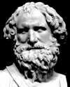
(2009-12-11) The [First] Theorem of Thales (intercept theorem).
The fundamental theorem of (classical) geometry.
Quand l'ombre de l'homme sera égale à l'homme,
l'ombre de la Pyramide sera égale à la Pyramide. Bernard Lefèbvre,
lecturing on Thales (1973)
Thales of Miletus was born in the
seventh century BC.
An engineer by trade, he is the first of the
Seven Sages of Greece.
Thales is credited with the first rational speculations about Nature
(natural philosophy).
The advent of natural philosophy was a fundamental step on the way to a real
understanding of Nature, compared to the primitive approach of "explaining" everything
by divine intervention (a viewpoint which is arguably still with us,
unfortunately). This became modern physics
only with the revolutionary introduction of the
scientific method of comparing speculations and observations!
Thales is also touted as the founder of classical geometry,
although some of it predates him
(including the construction with straightedge
and compass of the circle circumscribed to a triangle,
by the Phrygian mathematician Euphorbus).
Legend has it that Thales was asked to tell the height
of the Pyramid (possibly, the
Pyramid of Cheops).
His answer came down to me (via my high-school philosophy teacher)
in the eloquent form quoted at the
beginning of this section. Consider the
shadow of the Pyramid and the shadow of a man (or, rather,
the shadow of a vertical pole whose height is easy to measure).
Here's the key:
[First] Theorem of Thales :
If the corresponding sides
of two triangles are parallel, the triangles are similar
and the lengths of their sides are proportional.
[ Pause ]
How does this help? The two shadows may be proportional to the two heights and
we can quickly measure the shadow and the height of the vertical pole
but we know
neither the height of the Pyramid nor the length of its shadow!
Think about it: You are by yourself in this flat desert with your graduated yardstick next
to a pole of known height. How can you find the height of the
Great Pyramid?
One solution is to look for triangles which do not involve the inaccessible
center of the pyramid, as presented in the following picture
(courtesy of Andrew Weimholt, 2013-11-21).
There's a rudimentary
way to forgo any delicate sighting alignment or the measurement of long horizontal
distances. Can you guess what it is?
The geometry of Thales was formalized by
Euclid three centuries later.
For over two millenia, it
was thought to apply to our physical Universe.
The universe of classical geometry is postulated to be
homogeneous (Euclid's fourth postulate
states that all right angles are equal)
and unaffected by scaling (that's
what Euclid's fifth postulate really means).
The scale invariance of the microscopic Universe was questioned by the
ancient Greeks (Democritus
did speculate the existence of indivisible "atoms" with a definite size) but it was
thought to be an idiosyncracy of the content of the Universe...
Noneuclidean geometries were not even considered before the 19-th century.
However, we know now that the large-scale structure of our physical Universe is indeed
noneuclidean
(this is a consequence of General Relativity).
Yet, this conclusion could not have been reached without the
likes of Thales and Euclid
who set an ideal to compare against.
(2021-08-08) Berlin Papyrus 6691 and Rhind Papyrus
A glimpse of what the ancient Egyptians knew.
Papyrus isn't nearly as robust as clay but we have more mathematical papyri
than clay tablets from roughly the same historical period.
Partly because the ancoent Egyptian valued
recreational mathematics
more than contemporary societies did...
The historian David Fowler has argued convincingly that this order of precedence
was also a chronological one, during the early development
of mathematical concepts in ancient Greece, centered on
Plato's Academy...
(2006-10-19) Obliquity of the Ecliptic
Latitude of the Tropic of Cancer. Tilt of the Earth's axis of rotation.
Local high noon is the middle of the solar day. It's when the Sun
casts the shortest shadows.
On the summer solstice (June) and on the winter solstice (December) the Sun's rays
make two different angles with the local vertical.
The difference between these angles is always
twice the obliquity of the ecliptic.
Claudius Ptolemy
(AD 87-165) reports that
Eratosthenes of Cyrene
(276 BC-194 BC) had estimated the obliquity
of the Ecliptic to be:
11/83 of a half circle (180°) =
23.8554° = 23°51'20".
Eratosthenes, was merely 8' off the mark,
which is typical of the uncertainty in good angular measurements from antiquity (0.2°).
It turns out that the obliquity of the ecliptic changes slowly over time,
but its value in the times of Eratosthenes (i.e., when he was in his late thirties)
can be accurately estimated to be 23°43'30",
by putting T = -22.4 in this modern formula:
23°26'21.45" - 46.815" T - 0.0006" T2 + 0.00181" T3
The above is a standard approximation
for the mean obliquity of the ecliptic, as a function
of the time T counted from "January 1.5" of the year 2000
and expressed in "Julian centuries" of exactly 36525 days.
This means that, in the time of Eratosthenes, the Tropic of Cancer was
about 17 nautical miles (30 km)
north of its current (2006) latitude of 23°26'18".
The above formula also says that the Tropic of Cancer was at the latitude quoted by
Eratosthenes (11p/83) around 1347 BC.
Some have argued, backwards, that Eratosthenes did not measure the
obliquity himself (with a respectable accuracy for that period)
but used extremely accurate data from those earlier times...
This is either far-fetched or completely ludicrous.
(2006-11-06) The Ancient Wells of Syene
A vertical well in Syene is completely sunlit only once a year...
This ancient observation may have been part of the Egyptian folklore in the
times of Eratosthenes.
Exactly how ancient an observation could that be?
The latitude of Syene (modern Aswan) is about 24°06'N.
From the surface of the Earth, the radius of the Sun is seen at an angle of about 15'.
We're essentially told that the edge
of the Sun was lighting up the entire bottom of a vertical well
at Syene, just for a brief moment at noon on the summer solstice.
So, the center of the Sun must have been directly overhead at
a point exactly 15 angular minutes (15 nautical miles) to the south.
Therefore, the latitude of the Tropic of Cancer must have been 23°51'
at the time of the reports, if we assume they are perfectly accurate.
The above formula says that this happened about
33 centuries ago: Around 1300 BC.
However, as the verticality of a well is certainly of limited precision,
that date doesn't mean much.
The legendary observations could be made even today with a well that's tilted
by less than half a degree in the proper direction...
Any casual (or not-so-casual) observer will swear such a well to be "vertical".
Eratosthenes (6:41)
by Carl Sagan (Cosmos, Episode 1, 1980-02-28).
In this classic video, ignore Sagan's assertion that Eratosthenes had to "pay a man" to pace the distance between
Alexandria and Syene (this was already a well-known survey result at the time). Do not let that
detract you from the great moment of truth when Sagan bends the map and all falls into place.
(2006-10-14) 252 000 stadia around
(700 stadia per degree)
The size of the Earth, according to
Eratosthenes (276-194 BC).
Eratosthenes of Cyrene became librarian
of the Great Library of Alexandria
around 240 BC,
when his teacher Callimachus died.
Eratosthenes knew the
above story about the wells of Syene.
He took that to mean that the Sun was directly overhead at noon
on the summer solstice in Syene (modern Aswan).
This is almost true, because Syene is almost on the
Tropic of Cancer.
Eratosthenes did not know about the slow evolution with time
of the latitude of the Tropic of Cancer and he took the above at face value.
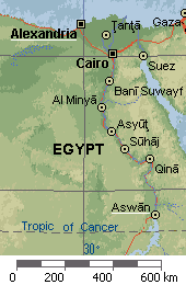
Let's do the same (slight) mistake by using the modern map at right,
as if Eratosthenes were alive today...
From his own location in Alexandria,
Eratosthenes saw that, at noon on the summer solstice,
the Sun's rays were tilted 1/50 of a full circle from the zenith
(i.e., 7.2° from the local vertical).
If we assume that Syene is due south from Alexandria,
this says that the distance from Alexandria to Syene is
1/50 of the Earth circumference (a posteriori, that's only 6% off).
The error from the difference in longitude between
the two cities roughly compensates the error
which places Syene on the Tropic of Cancer.
That's because, as the above map shows,
the meridian of Alexandria (about 30°E)
crosses the Tropic of Cancer at a point which is about the same distance
from Alexandria as Syene (Aswan).
As the distance between Alexandria and Syene,
was reputed to be 5000 stadia,
Eratosthenes estimated the circumference of the Earth to
be 250 000 stadia.
This estimate was then rounded up to 700 stadia
per degree, which corresponds actually to 252 000 stadia
for the whole circumference (360°).
Unfortunately, we can't judge the absolute accuracy of that final result, because
we don't know precisely what kind of stadion
(or stadium) was
meant in the Alexandria-to-Syene distance quoted by Eratosthenes.
The latter ratio justified the introduction of the current "statute" mile
of 8 furlongs (1593) to replace the former
"London mile" (itself based on the Roman ratio of 5000 feet to the mile).
The ratio of 600 feet to the furlong, which made the furlong a "modern" equivalent
of the stadion, pertained to the deprecated "Saxon
foot", which was 11/10 of the "modern" foot
(henceforth, 1 ft = 0.3048 m).
A furlong is thus 660 ft.
However, the exact length of a Greek foot varied from one city to the next.
Arguably, Eratosthenes would have been likely to use
the Attic stade of 185 m
(8 Attic stades to the Roman mile).
In any case, his estimate was certainly
no worse than 20% off the mark and it may have been much better than that...
A circumference of 252 000 stadia would be only 1%
off if Eratosthenes, wittingly or unwittingly, had
been calling a "stade" an Egyptian surveying unit of 157 m,
which was sometimes identified with a Greek stadion.
That very low error figure of 1% is often quoted, but it's clearly
misleading by itself, because intermediary steps do not attain the same accuracy.
The great achievement of Eratosthenes
was to realize that the circumference of
the Earth could be estimated with some accuracy from a single angular measurement
and a few "well-known" facts, which happen to be approximately true.
By exaggerating the accuracy of the result, some commentators only cloud the issue.
Archimedes (287-212 BC)
quotes 300 000 stadia
as the figure "others have tried to prove" for the circumference of the Earth.
He does so in one of his most famous pieces:
De Arenae Numero (The Sand Reckoner)
where his main concern with upper bounds led him to use
a number ten times as large, just to be on the safe side.
There is very little doubt that Archimedes was thus referring to [a rounded up version of]
the estimate of his younger contemporary.
Archimedes reportedly treated Eratosthenes as a peer.
There may well have been some rivalry between the two men,
which might be why Archimedes avoids mentionning the name
of Eratosthenes in a text where he give meticulous credit to many others.
To Archimedes and Eratosthenes, the "traditional" estimate for the
circumference of the Earth was most probably the one quoted by
Aristotle (384-322 BC) in
On The Heavens, namely: 400 000 stadia.
This number was attributed by Aristotle himself to previous
mathematikoi [the term usually applies to the elite
followers of Phytagoras (c.582-507 BC) but it has been argued that Aristotle
could have meant to credit ancient Chaldean astronomers].
That tradition may help gauge the numerical breakthrough achieved by Eratosthenes.
It may also explain why Archimedes didn't find it prudent to use
the result of Eratosthenes in his own Sand Reckoner essay.
Details on the above work of Eratosthenes about the circumference of the Earth
are only known to us through the astronomy textbook
Caelestia (The Heavens) by
Cleomedes,
which was written between AD 320 and 420, according to
Otto Neugebauer (1899-1990).
(2019-01-03) The Earth is Round
The ancient Greek scholars already knew that. How can we be so sure?
This would have been a silly question a few short years ago,
since we now have pictures taken from distant outer space which leave absolutely no doubt
concerning the spherical shape of the Earth
(careful analysis would reveal that it's closer to an oblate spheroid).
As post-modern
pop culture
favors bullshit receptivity so much (in
a sense coined by the philosopher Harry G. Frankfurt in 2005)
in may now be useful to offer a quick justification for what shoukd be common knowledge:
The above angular measurements of
Eratosthenes involve two
distant wells. They enabled him to estimate the circumference of the Earth
assuming it was round. That would still be compatible with
the hypothesis of a flat Earth if the Sun was
not very distant.
With three wells or more that ambiguity would be lifted,
leaving only one possible explanation compatible with the observed angles:
All rays from the Sun are nearly parallel
(because the Sun must be very distant)
but they make different angles with the verticals at diferent locations
with have different directions because of the
curvature of the Earth surface.
Another reliable clue that the Earth must be spherical is that
it alwasys casts a circular shadow on the Moon during solar eclipses.
Observations within the atmosphere are nice too
(boats disappear hull first) but they can be less reliable
because air can easily curve light downward or upward,
depending on meteorological conditions:
The ever-present downward pressure-gradient is already enough to bend light-rays downward
by about half
of what's needed to make the surface of the Earth look flat.
When the temperature gradient is also downward (e.g.,
warm air over cold water) light rays can curve more
than the surface of the Earth's surface which makes the surface
of the Ocean look like the inside surface of a shallow bowl.
In that case, you can see boat hulls and islands well beyond the
geometric horizon.
(2010-07-04) Computing the distance to the Moon
Aristarchus used lunar eclipses. Hipparchus used solar eclipses.
Around 270 BC,
Aristarchus of Samos remarked that the angular size of
the shadow cast by the Earth on the Moon's orbit (readily obtained by timing the maximum
duration of a lunar eclipse) gave the ratio of the size of the Earth to the
Earth-Moon distance. From this, he correctly deduced that the distance to the
Moon was about 60 Earth radii.
The size of the Earth itself would be estimated later by Eratosthenes.
Hipparchus of Nicaea (c.190-126 BC)
confirmed that result independently by noting that a total solar eclipse
over a known remote location (see below) was observed in Alexandria
as a partal eclipse leaving 1/5 of the solar width (30'
or 0.5°) still visible. So, the angular separation
between those two earthly locations, seen from the Moon, was about 6' (0.1°).
Assuming a knowledge of the two positions on Earth,
Hipparchus (who invented trigonometry!) could deduce
the distance to the Moon (as 573 times the distance separating two parallel sunrays
through the two locations).
He reportedly
deduced that the Moon's distance was no less than 59 times the radius of the Earth
(close to the modern number of 60.3).
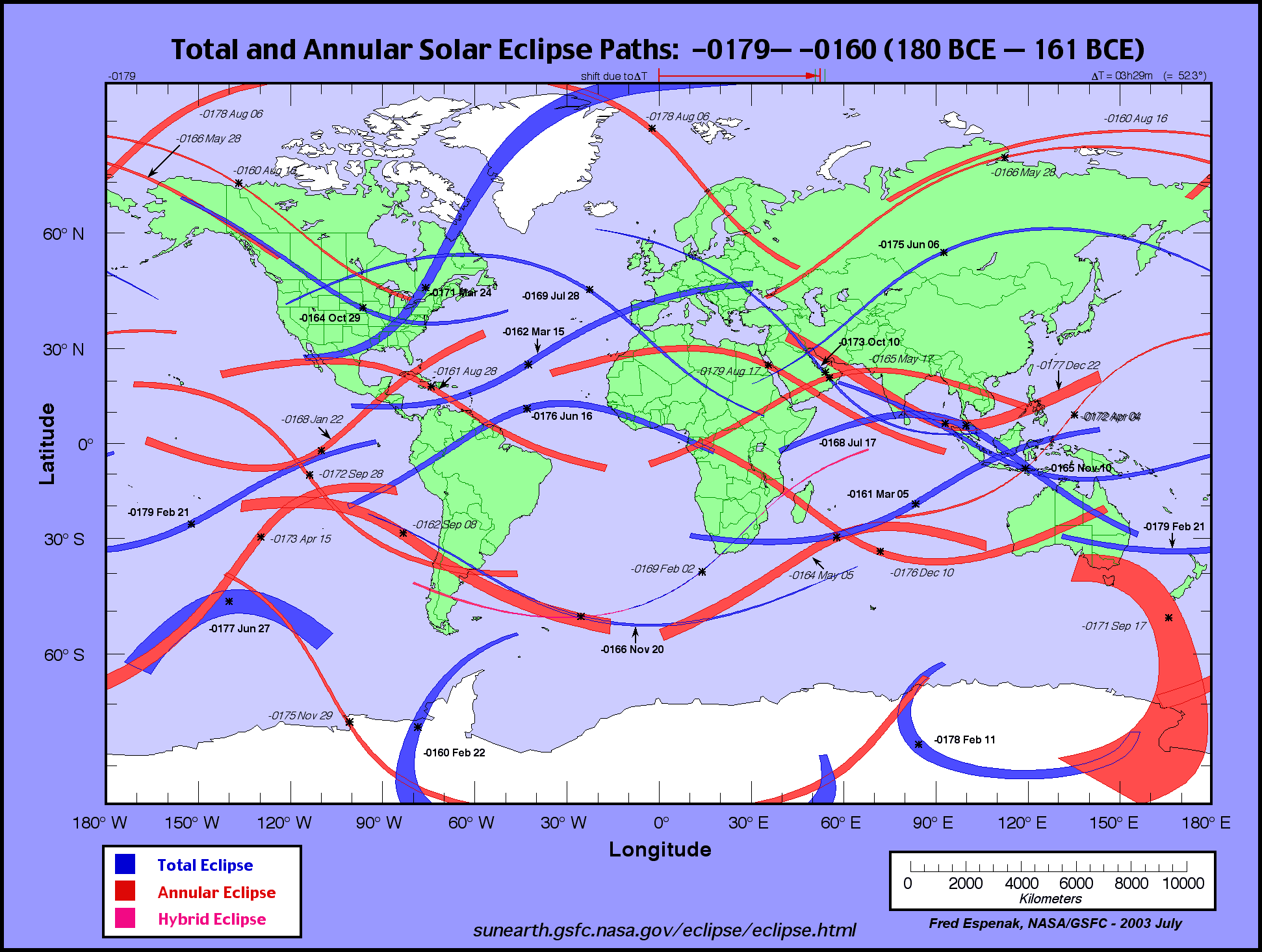
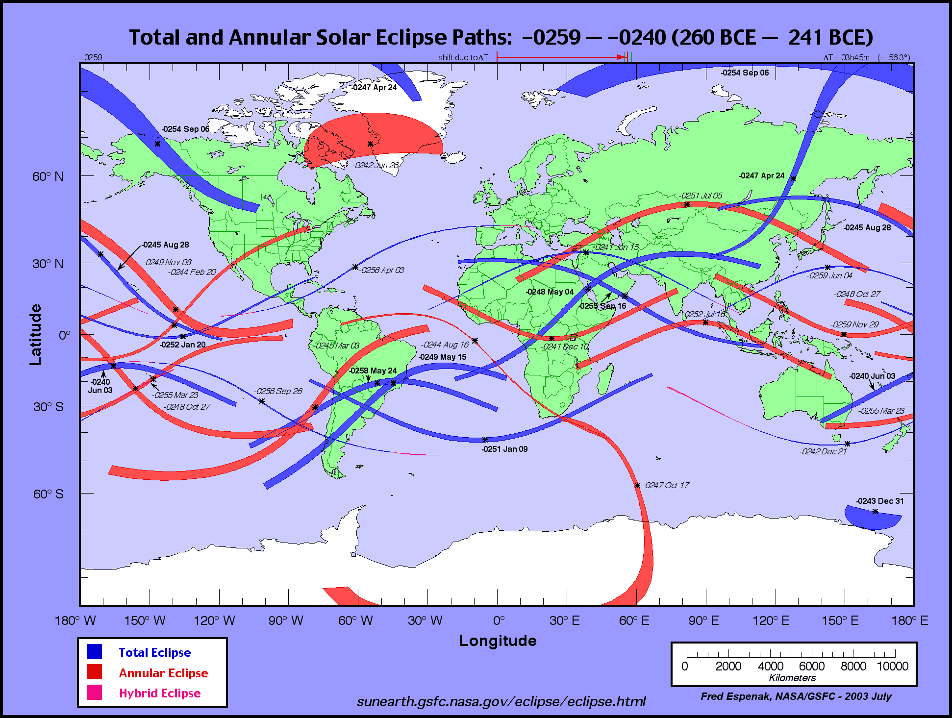
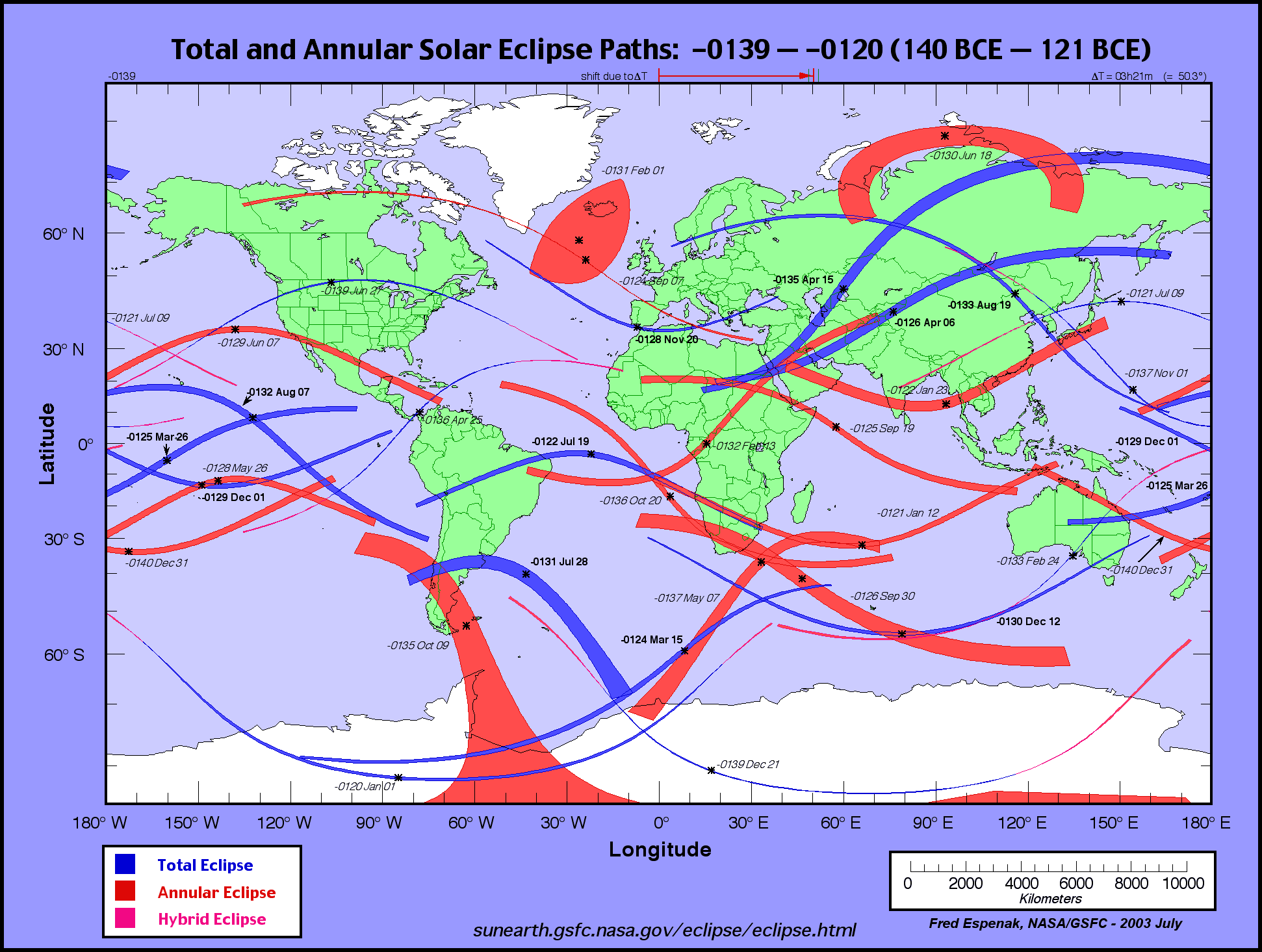
Where and When ?
There is some debate concerning the date and location of the solar eclipse used by
Hipparchus.
In the lifetime of
Hipparchus,
only one total solar eclipse occurred over Syene
(technically, it was an annular eclipse).
It took place on
August 17,
180 BC at a time when Hipparchus was probably just a boy.
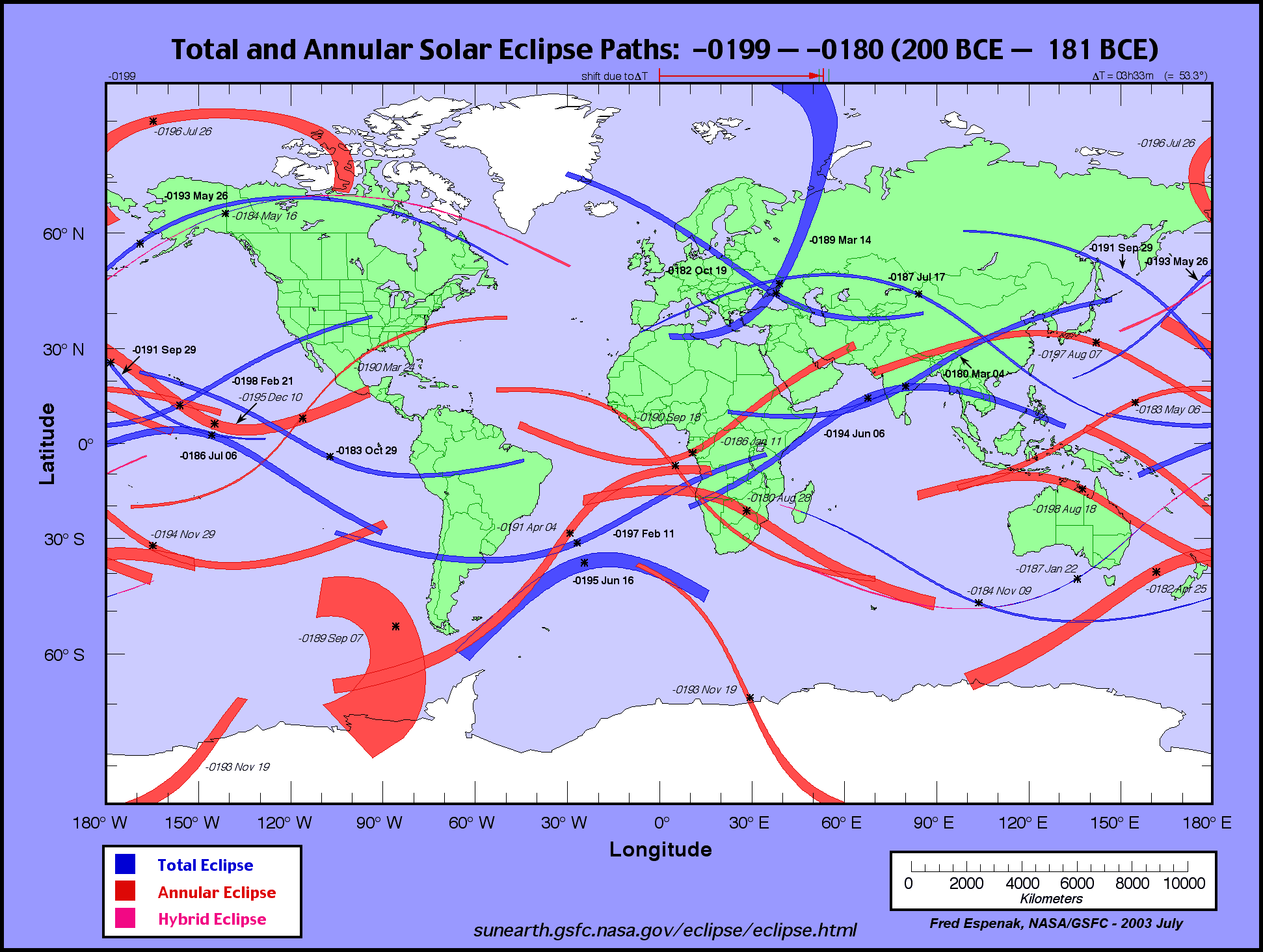
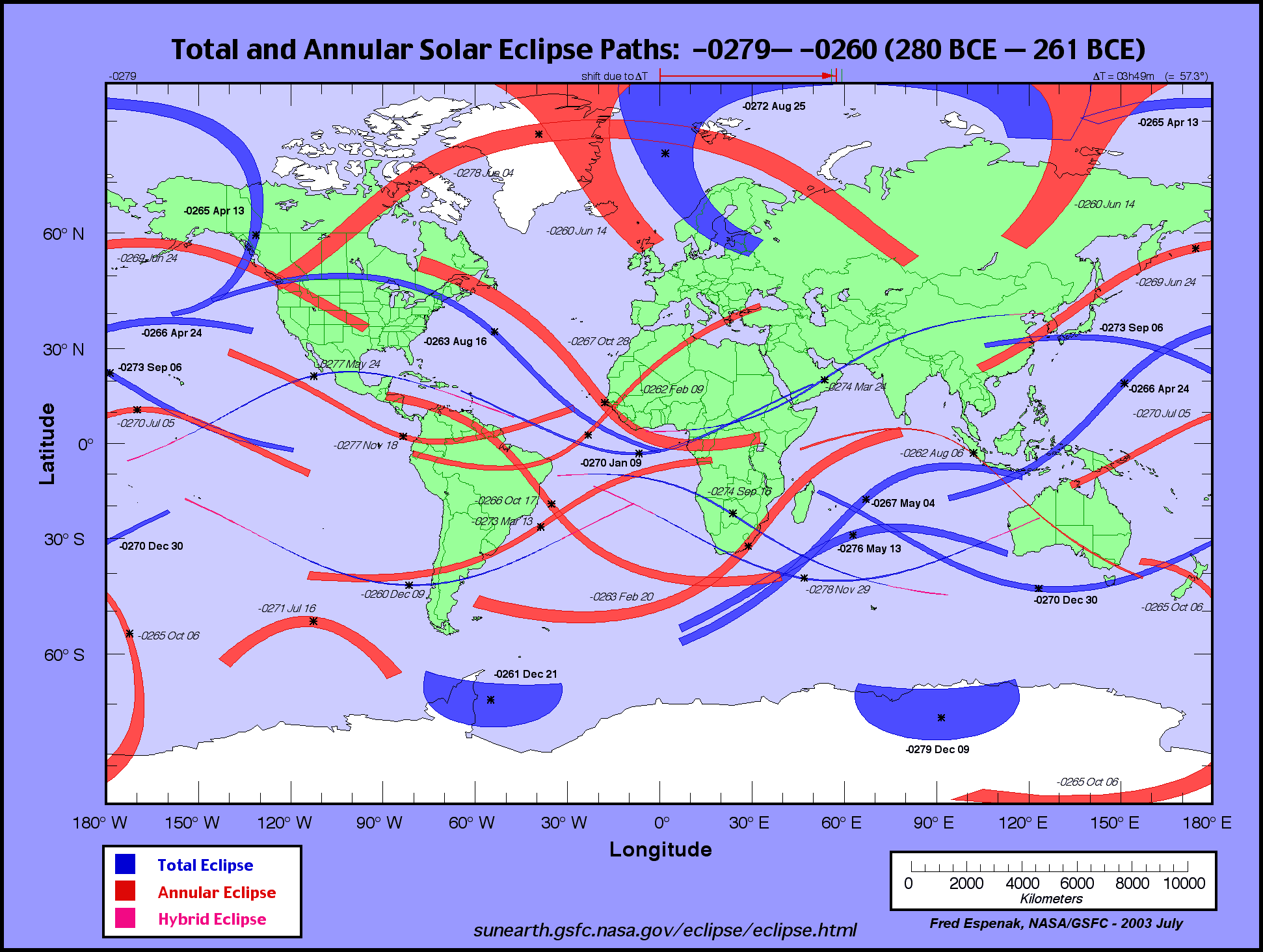
The previous total solar eclipse over Syene had occurred 80 years before,
on September
16, 260 BC. (Courtesy Fred Espenak of NASA, July 2003.)
However, it seems that Syene was not involved at all in this.
Reports to the contrary are probably simply due to a confusion with the
related story about Eratosthenes estimating the size of the Earth.
Instead, Hipparchus reportedly used an eclipse over the Hellespont
(the Dardanelles strait).
It was most probably the solar eclipse of
November 20,
129 BC (astronomers assign the negative number -128 to the year 129 BC,
just like they assign the number 0 to the yesr 1 BC, which came just before AD 1).
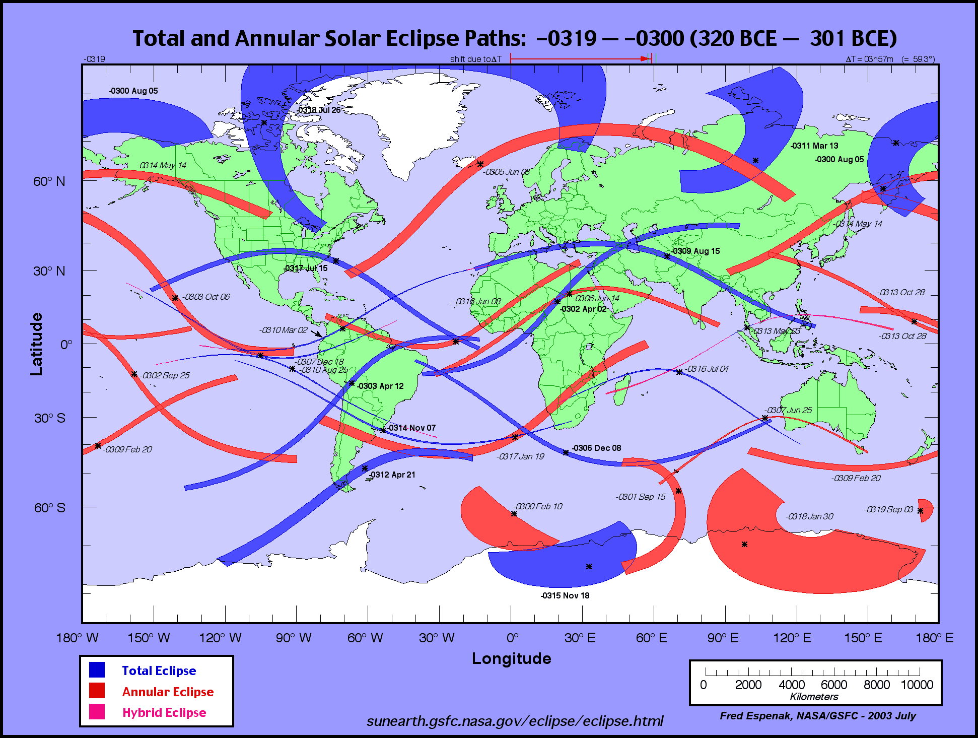
Previous total or annular solar eclipses over the Dardanelles took place in
190 BC,
263 BC,
310 BC
and
340 BC.
(2006-11-04) Latitude and Longitude
Covering the Globle with a grid of parallels and meridians.
The idea of using a system of spherical coordinates to locate points on
the Earth is credited to
Hipparchus of Nicaea (c.190-126 BC)
who first used it to map the heavens.
Latitude :
There's no doubt that the notion of latitude is extremely ancient.
Any smart shepherd who looks up several times in a single night,
would notice that all star patterns revolve around a special point in the
sky: the celestial pole.
The celestial north pole is currently close to the position of the star we
call Polaris or North Star.
This wasn't always so,
because of the precession of equinoxes
(discovered by Hipparchus
in 130 BC):
The polar axis varies slowly, like the axis of a spinning top does.
In the main, over a period of
about 26000 years,
it goes around a large circle of angular radius
e » 23.44°
(which is the mean obliquity of the ecliptic ).
About 14000 years ago, the bright star
Vega
(a-Lyrae,
magnitude 0.03) was only 3°86'
from the celestial pole (that angle is still more than 7 times the width of the Moon).
For completeness, note that
the axis of the Earth oscillates around
the position predicted by the above circular motion, just like
the axis of a spinning top does
(nutation
motion).
This translates into a periodic variation of the obliquity of the ecliptic,
which astronomers approximate with a polynomial function of time,
valid for a few centuries.
The angle between the celestial pole and the plane of the horizon is
the local latitude,
which can be measured to a precision of about 0.2° with elementary tools
(angular units need not be assumed; the result
could be expressed as a fraction of a whole circle).
Even without formal measuring,
this special angle could be materialized by erecting
pointers to the celestial pole, aligned by direct observation
(possibly for religious reasons).
By contrast, the next logical step was undoubtedly one of mankind's major prehistorical
discovery: "Latitude" (as defined above) changes from one place to the next!
The breakthrough was the idea that such a change might occur.
After that, actually observing it is relatively easy...
The change is already noticeable after walking only 3 or 4 hours to the north or to the south
(if you look carefully enough). A major voyage would make it totally obvious...
We may thus guess that the modern notion of latitude is very old, since
people have been navigating and observing changes in latitude for a very long time:
Sailing ships already traveled along the Nile river around 3100 BC.
Solid wooden boats existed before 6000 BC in Europe,
skin and bark boats have been traced to
16 000 BC.
There's some evidence that people from Southeast Asia already had seagoing capabilities
and sophisticated navigation skills as early as 60 000 BC (some of them
reached Australia and settled in Melanesia around 40 000 BC).
The Norwegian explorer Thor Heyerdahl (1914-2002)
spent a lifetime proving that such prehistorical voyages were a practical possibility,
starting with the celebrated Voyage of the Kon-Tiki in 1947.
Longitude :
Longitude is a different story entirely.
Until reliable chronometers became available, longitude was mostly an intellectual
construct based on the assumption that the Earth was spherical (or nearly so).
The difference in longitude between two points could only
be estimated on firm land, by using surveying techniques after
some fairly good knowledge of the size of the Earth had been gained
to calibrate the whole process, like Eratosthenes did.
Hipparchus (who was born when Eratosthenes died)
was thus in a position to make the notion of terrestrial longitude a practical proposition.
However, more than 1600 years would pass before someone like
Christopher Colombus would be willing to bet his life on the
scholarly belief that the Ocean was small enough to sail through...
(2006-10-17) Itinerary Units: Land Leagues
and Nautical Leagues
Matching land surveys and degrees of latitude at sea.
Perhaps the most interesting ancient itinerary unit is the league.
It comes in two flavors, land league and nautical league
(each with many definitions).
The Latin for "league" (leuga) comes from the Gallic leuca
[ not the other way around ] which was supposed
to be equivalent to an hour of walking.
This land league was identified with 3 "miles" whenever and wherever some flavor of the
"mile" was the dominant itinerary unit (Roman mile, London mile, Statute mile).
The original "mile" was the military
Roman mile of a thousand steps.
Each of those steps was properly a double-step (or stride) which the Romans
reckoned to be 5 (Roman) feet.
Land League(s) :
Officially, each flavor of the land league remained quite stable over time,
although actual recorded measurements may show some lack of
precision for both local land surveying and itinerary measurement.
Among the many "leagues" born in the Old World,
Roland Chardon singles out 5 which took hold in North America:
French lieue commune of 3 Roman miles (4444 m).
French grande lieue ordinaire
(3000 pas = 4872.609 m).
French lieue de poste (2000 toises =
3898.0872 m).
Mexican league,
legua legal (3000 pasos de Solomon = 5000 varas = 4191 m)
Castilian legua común,
legua regular antigua, modern
legua (20000 pies
de Burgos = 5572.7 m)
The Spanish system comes in different flavors whose basic units differ slightly,
but all of them have 5 pies to the paso and 3 pies to the vara.
The vara may also be subdivided into 4 cuartas or 8 ochavas.
The vara de Burgos was apparently first established in 1589, but was given
its final metric definition (0.835905 m) only in 1852, as Spain was converting
to the metric system.
It competes with the vara of California
(now identified with the ancient vara de Solomon)
which the Treaty of Guadalupe Hidalgo (1848) set to 33 inches (0.8382 m)
to replace no fewer than 22 variants previously flourishing in California...
The so-called "vara of Texas" was defined in 1855 (3 of those are exactly 100 inches).
Nautical League(s) :
Each version of the nautical league was normally defined as a simple fraction
of the (average) degree of latitude.
The nautical league which (barely) survives to this day is 1/20 of a degree (3 nautical
miles) but another nautical league of 1/15 of a degree (4 nautical miles) used to be
almost as common.
The ratio of the nautical units to the land units varied historically,
as the accepted size of the Earth varied
(normally becoming more accurate with the passage of time).
Nautical league of 20 per degree (equal to 3 modern nautical miles).
Dutch or Spanish marine league of 15 per degree (4 nautical miles).
In the early 1500s, these two were respectively equated to 3 and 4
Roman miles, which represents an underestimate of 20%, since
a Roman mile is only 80% of a true nautical mile.
That error was all but corrected by the mid 1600s.
The pre-metric value for the league "of 20 per degree" was
2850 toises (5554.8 m).
The conventional modern value of the nautical league is 5556 m
(3 nautical miles of 1852 m).
The deprecated definition of the nautical mile
as an "average minute of latitude"
is treacherous, because of the implied
averaging over the surface of an oblate spheroid.
Also, "latitude" comes in two distinct flavors: geocentric and
geodetic.
Still, Livio C. Stecchiniargues
that a "memory of the Roman calculation" of 75 Roman miles to the degree of latitude
was preserved trough medieval times.
This is so nearly perfect that it seems entirely too good to be true...
(2008-03-10) Amber, Compass and Lightning
The ancient mysteries of electricity and magnetism.
The word electricitycomes from the greek word for
amber
(hlektron).
The new latin word electricus
was coined by William Gilbert
in De Magnete (1600)
to denote the basic triboelectric
properties of amber:
Amber is a transparent material consisting of hardened resin from conifers
(mostly of the family Sciadopityaceae
that flourished in the Baltics
44 million years ago). If you rub it against wool, polished
amber attracts nearby dust or dry leaves.
Thales of Miletus (c. 624-546 BC)
recorded that observation around 600 BC.
About 80% of the World's amber
(100 000 metric tons) was produced 44 million years ago in forests of
the Baltic Region.
Natural Baltic amber
is sometimes known as succinite because it contains from 3%
to 8% of succinic acid
(a solid also known as "spirit of amber"). Succinic acid is the third simplest
dicarboxylic acid;
its formula is HOOC(CH2 )2 COOH
(butanedioic acid) and it plays an essential metabolic rôle
in the Krebs cycle.
In 1620, Niccoló
Cabeo (1586-1650) observed that two electrified objects can either
attract or repel. An electrified object always attracts an unelectrified one.
In 1733,
Charles
François du Fay (1698-1739)
discovered that there are actually two opposite
types of electrical charges, which he called
resinous
and vitreous.
Unlike charges attract each other, like charges repel.
The attraction exerted by either kind of charges on any unelectrified
object is due to the influence of a charged
body on a neutral one.
Charges are redistributed within the latter:
Unlike charges are pulled closer and like charges are pushed away.
As distant charges have a lesser action than close ones, there's a net pull.
We now speak of negative charges (resinous)
and positive charges (vitreous) according to the arbitrary
algebraic sign convention which was introduced before 1746
by Benjamin Franklin
(1706-1790) to formulate the fundamental principle of
conservation of electric charge
which is attributed jointly to him and to the British scientist
William
Watson (1715-1787).
Various materials acquire a definite electric charge when rubbed.
Amber becomes negatively charged.
Glass acquires a positive charge.
This phenomenon is known as
triboelectricity
(electricity produced by friction).
Electrostatic machines depend on it but the effect remains fairly difficult to
quantify precisely, because it depends critically on a variety of factors which are
tough to control (e.g., surface condition and humidity).
The following list, known as the triboelectric series,
predicts fairly accurately (under typical conditions) which material will acquire
a positive charge and which material will acquire a negative charge when they are
separated after being rubbed against each other: The earlier the material
appears in the series, the more positive it will tend to be.
Triboelectric Series
Strongly Positive
Human skin, Leather, Rabbit's fur Glass, Quartz, Mica
For many century, magnetism was perceived as
a phenomenon unrelated to electricity.
Legend has it that it was first observed around 900 BC
(by a Greek shepherd called Magnus) through the ability of a certain mineral
to attract bits of iron.
The mineral was called magnetite because it was commonly
found in a region named Magnesia (Central Greece).
The region gave its name to the rock
(Fe3O4 ) the rock gave its name to the
phenomenon.
Arguably, the first scientific paper ever written
is a treatise on magnetism known as
Epistola de Magnete,
written in 1269 by the French scholar
Petrus
Peregrinus (Pierre Pèlerin de Maricourt ).
The notion of conservation of energy would emerge only much later,
so Peregrinus should be forgiven for his misguided belief that magnetism
might produce perpetual motion!
He was writing more than three centuries before
Sir William Gilbert
(1544-1603) [William Gylberde of Colchester]
published De Magnete (1600).
One major contribution of Peregrinus was the observation that
magnetic poles (which he
defined) always come in opposite pairs.
A magnetic pole cannot be isolated from other poles of the opposite
polarity; every piece of lodestone features both kinds of poles.
The modern statement
(for which no exceptions have been found to this day)
is that "there are no magnetic monopoles"
(the simplest magnetic distribution is a dipole).
This is expressed mathematically by one of the four
equations of Maxwell
(div B = 0).
Unlike the other three, that particular equation does not currently enjoy the
privilege of a universally accepted specific name.
It's sometimes referred to as "Gauss's law for magnetism",
which is dubious. To be understood, I've been calling it
the "Gauss-Weber law" myself, but it should really be called
either the Law of Peregrinus or
Pèlerin's Law, in honor of the
scientific pioneer who first stated it (in the language of his day).
Grosseteste
Petrus Peregrinus and the Dawn of Modern Science:
The scientific method
[of comparing theories with observations]
was formally conceived by
Robert Grosseteste (1168-1253)
at Oxford, where he taught
Roger Bacon (1214-1292).
Bacon and
Pierre Pèlerin de Maricourt (Peregrinus)
belonged to the next generation, who would start practicing Science according
to the rules laid down by Grosseteste.
Roger Bacon's own manuscripts (c. 1267)
give high praise to Peregrinus whom Bacon had met in Paris
(however, the object of that praise is only unambiguously
identified asMagister Petrus de Maharn-Curia, Picardus
in a marginal gloss of a
copy of Bacon's Opus Tertium, which may have been added by someone else).
Apparently,
Bacon himself had no great interest in Science until he met Peregrinus.
Although most of the work of Peregrinus is now lost, we know that he was an outstanding
mathematician, an astronomer, a physicist, a physician, an experimentalist
and, above all, a pioneer of the scientific method...
He may have been described as a recluse devoted to the study of Nature, but he was
actually a military engineer who, in the aforementioned words of Roger Bacon,
was once able to help
Saint Louis
(Louis IX of France, 1214-1270) "more than his whole army"
(as Peregrinus seems to have invented a new kind of armor).
One of the 39 extant copies of De Maricourt's Epistola de Magnete
attests that it was "done in camp at the siege of
Lucera, August 8, 1269".
Peregrinus was then serving the brother of Saint-Louis,
Charles of Anjou,
King of Sicily.
The letter is adressed to a fellow soldier called
Sygerus of Foucaucourt
who was clearly a countryman/neighbor of Pierre,
back in Picardy
(the village of Foucaucourt is 12 km to the south of the village of Maricourt,
across the Somme river).
Petrus Peregrinus de Maricourt and his Epistola de Magnete
by Silvanus P. Thompson, D.Sc., F.R.S. (1906)
Proceedings of the British Academy, Vol. II.
Oxford University Press.
The Letter of Petrus Peregrinus on the Magnet, A.D. 1269
translated by Brother Arnold, M.Sc. Introduction by
Brother Potamian, D.Sc. (1904).
Digitized in 2007.
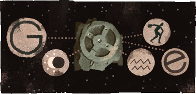
(2017-05-17) The Antikythera Mechanism
The earliest known orrery. (French: La machine d'Anticythère.)
On 1902-05-17, the Greek archaeologist
Valerios Stais (1857-1923)
spotted gears in a corroded chunk of metal recovered in 1901 from a wreck
located
off Point Glyphadia
on the island of Antikythera,
West of the Sea of Crete.
This was part of an ancient mechanical computer,
now known as the Antikythera Mechanism.
Marking the 115th anniversary of this discovery,
Google showed the following Doodle on their homepage, on May 17, 2017:
That intriguing artefact was found in the remains of a wooden box measuring appeoximately
34×18×9 cm.
It captured the imagination of generations of scholars.
It's the earliest known geocentric orrery.
It comprised at least 37 gears.
The largest of these (e3) was about 13 cm in diameter,
with 223 teeth (there are 223 synodic months in a
Saros).
and has
In 1951,
Derek J. de Solla Price (1922-1983)
was the first major scholar to take a serious interest in the mechanism.
In 1974, he concluded that it had been manufactured around 87 BC.
The Corinthian origin of the mechanism can be established by the names of some of the months
engraved on it. It was most likely manufactured in Corinth itself or one of
its major colonies: Corfu
(Korkyra) or
Syracuse,
home of Archimedes (c. 287-212 BC)
Several concurring clues indicate that the shipwreck took place around 60 BC.
In 1976, the team of Jacques Coustau (1910-1997)
found coins in the wreck which were dated between 76 BC and 67 BC.
The amphorae are only slightly more recent.
The nature of the cargo seems to indicate that the ship was bringing Greek loot to Rome (Ostia).
Few harbors could accomodate a commercial ship of that size.
This leaves only few possibilities for the origin of her last voyage:
The tooth-count of the gears of the Antikythera Mechanism
allow the reproduction of heavenly motions using the best rational approximations
known to the Ancients. Some prime numbers are prominent
(A240136):
19: The approximate number of solar years in a Metonic cycle.
53: See below.
127: The approximate number of sidereal months in half a saros.
235 = 5 . 47 : The number of lunar months in a Metonic cycle.
The saros (also called 18-year cycle) is defined
as exactly equal to 223 mean synodic months. That's approximately 6585.321
mean solar days or 18.0296 Julian years.
The eureka moment of Tony Freeth can be summarized by the equation:
It could have been discovered immediately by expanding an approximation of the right-hand-side
as a continued fraction, but Tony's candid account
of his own discovery of 53 (by trial and error) makes for better
video footage,
albeit poorer mathematics.
Pin-and-Slot Couplings :
One remarkable device used many times in the Antikythera Mechanism
is the Pin & slot coupling (first uncovered by Michael Wright)
whereby a pin parallel to the axis of a gear slides in a slot carved in another gear revolving
around a slightly different center.
The average rate of rotation of two gears so coupled will be
the same but the two rotations are not uniformly related to each other.
(2021-07-06) The Pythagoreans
The cult of Pythagoras and the discovery of irrational numbers.
Any religion consists of two distinct parts:
Religious beliefs. Mythology and theology.
Religious practice. Rules, rituals and festivals.
The Pythagoreans beliefs were derived from the Orphic form
of the cult of Dionysos.
Their srict practices included an obsessive respect for beans,
believed to be a repository for some human souls.
Much of that was ridiculed by outsiders, even in ancient times.
Pythagoras (c.569-c.495 BC)
received at least part of his mathematical education from
Anaximander of Miletus (610-546 BC)
head of the Milesian school founded by
Thales (c. 624-546 BC)
whom the young Pythagoras also met.
On religious matters however, Pythagoras followed the teachings of
Pherecydes of Syros
whose main tenet was the immortality of the soul through
metempsychosis.
Pythagoras was the first person in Greek history to call himself a philosopher
(literally, a "lover of wisdom").
He was also the first to propose the momentous idea of a
spherical Earth, which Plato accepted on
aesthetical grounds before Aristotle
gave three solid physical arguments for it:
The celestial North is closer to the horizon after a long journey South.
In any lunar eclipse, the shadow of the Earth is always perfectly round.
Departing boats disappear behind the horizon hull first.
The father of Pythagoras, called Mnesarchus, hailed from Tyre and was granted citizenship
in Samos because he had brought corn to the city in a time of famine.
He settled in Samos as a gem engraver.
Mnesarchus was a religious man who consulted Pyhtia, priestess of Appollo
(the Oracle of Delphi) who told him that his wife, ,
was pregnant with a child destined to great fame. Upon hearing this the mother
changed her own name from Parthenas to Pythais and they chose to name their son Pythagoras
after the Pythia.
Pythagoras was probably the main source for the first two books in
Euclid's Elements but,
over time, his achievements became considerably exaggerated, casting
much doubt on biographies which were written several centuries after his death.
Like Socrates, Pythagoras didn't leave any written work of his own,
Unlike Socrates, who was heralded by Plato and Xenophon,
Pythagoras wasn't written about by any of his followers,
who were not encouraged to do so (to say the least).
The only extant contemporary account is a short excerpt from
Heraclitus of Ephesus (c.535-475 BC)
who was 35 years younger than Rythagoras. Heraclitus wrote:
"Pythagoras, son of Mnesarchus, practiced inquiry more than any other man,
and selecting from these writings he manufactured a wisdom for himself; much learning, artful knavery."
Samos is an island off
the coast of mainland
Anatolia (Asia Minor)
were Miletus
is located (in modern-day Turkey).
Samos and Miletus waged a
war against each other
in 440/439 BC.
Miletus was under the military protection of Athenian forces commanded by
Pericles.


